Big Sur Chipping Program
CAL FIRE has awarded a Wildfire Prevention Grant of $1,165,250 to fund the five-year cost share Fire Adapted Big Sur Chipping Program! The program will be available to all residents that access Hwy 1 between Malpaso Creek and the San Luis Obispo County line. We anticipate a Q1 2025 rollout.
Stand by for updates as the chipping program is designed and implemented.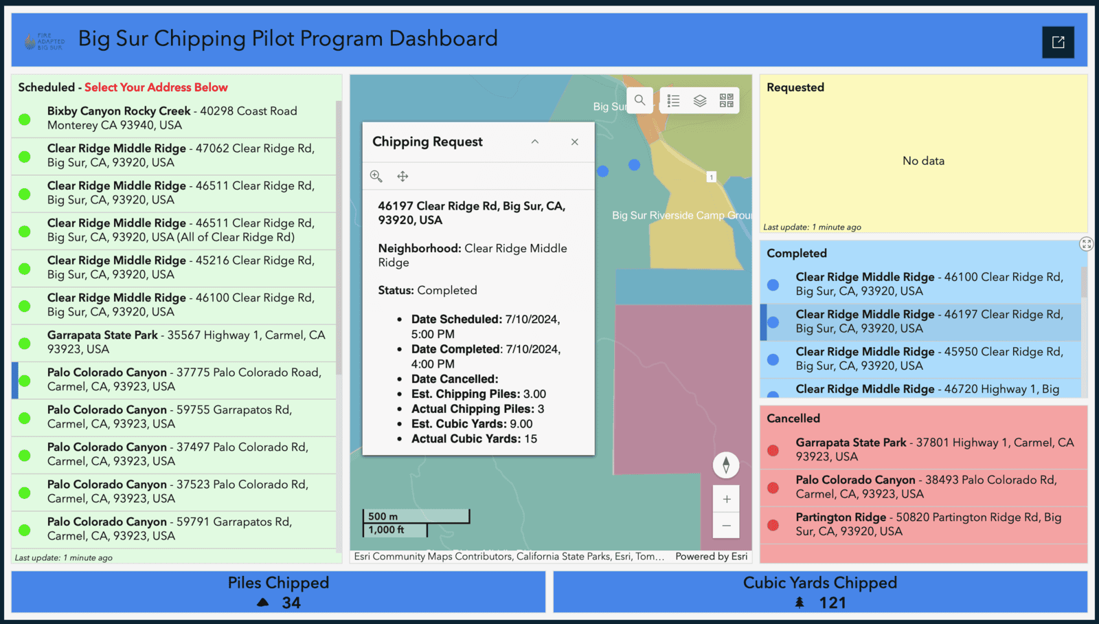
Big Sur Chipping Pilot Program
The July 2024 Fire Adapted Big Sur Chipping Pilot Program was a success! Over 10 days, we serviced 37 residential properties and two road associations, chipped 219 piles of vegetation resulting from defensible space work, and produced 342 cubic yards of chips. THANK YOU to: the Clear Ridge, Palo Colorado Canyon, Partington Ridge, Coastlands, Bixby Canyon, Garrapata Beach, and Rancho Rico neighborhoods for participating; Perez Services (Fabian, Pepe, Junior) for your exceptional work; and our generous donor who funded the pilot program! Big Sur Chipping Pilot Performance Report.
Big Sur Safety and Evacuation
What’s important to YOU and YOUR NEIGHBORHOOD? We invite you to participate in our Big Sur Safety and Evacuation Survey. This is an opportunity for you to be heard and help steer your neighborhood evacuation planning activities. Survey responses are posted real-time in the Big Sur Safety and Evacuation Survey Dashboard below. Based on these results, we’ll create an action plan to move forward with those neighborhoods that are interested in developing safety and evacuation plans. The survey is available in Spanish and English.
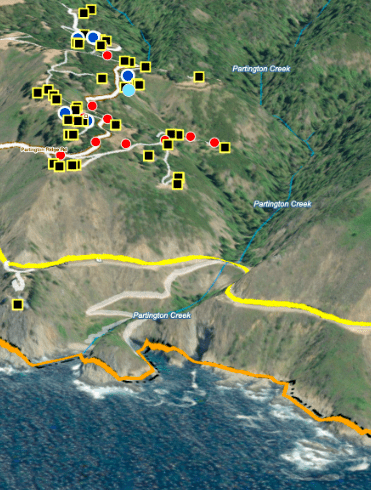
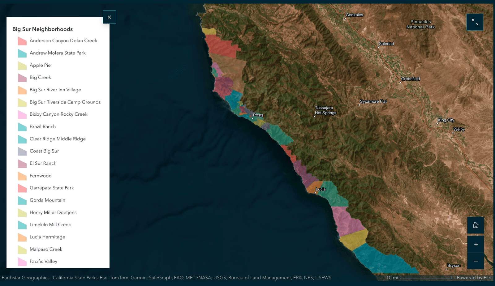
Big Sur StoryMap
The Big Sur StoryMap is a series of interactive two- and three-dimensional maps containing infrastructure, terrain, weather, fire history, and other information useful for becoming a fire adapted community. These maps are presentations of local data contained in Geographic Information Systems (GIS).
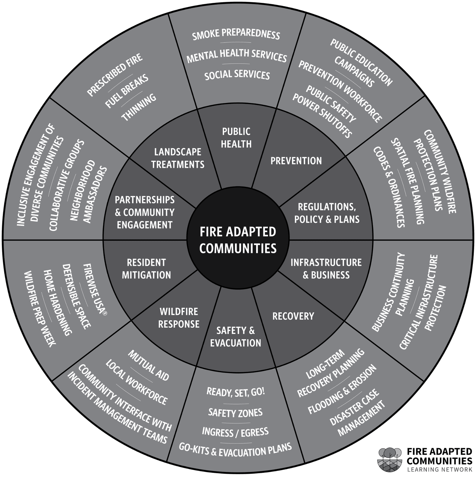
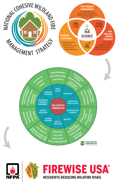
Origins
The National Cohesive Wildland Fire Management Strategy (Cohesive Strategy) is a strategic framework, rooted in science, that guides stakeholders to work collaboratively to make meaningful reductions in risk and learn to live with wildland fire.
The three overarching goals are: 1) Restore and Maintain Landscapes. Landscapes across all jurisdictions are resilient to fire-related disturbances in accordance with management directives. 2) Fire Adapted Communities. Human populations and infrastructure can withstand a wildfire without loss of life and property. 3) Wildfire Response. All jurisdictions participate in making and implementing safe, effective, and efficient risk-based wildfire management decisions.
A fire adapted community is a human community consisting of informed and prepared citizens collaboratively planning and taking action to safely coexist with wildland fire. More fully, fire adapted communities are knowledgeable, engaged communities where actions of residents and agencies in relation to infrastructure, buildings, landscaping and the surrounding ecosystem lessen the need for extensive protection actions and enable the communities to safely accept fire as part of the surrounding landscape.
The national Firewise USA® recognition program, a component of Fire Adapted Communities®, provides a collaborative framework to help neighbors in a geographic area get organized, find direction, and take action to increase the ignition resistance of their homes and community and to reduce wildfire risks at the local level. Any community that meets a set of voluntary criteria on an annual basis and retains an “In Good Standing Status” may identify itself as being a Firewise USA® site.